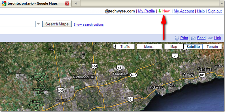
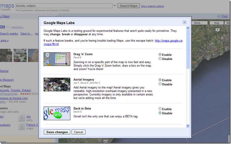
 Google Maps recently added tools from Google Labs to the top right menu, allowing users to experiment with a variety of image and mapping extensions that add to the user experience. From zooming tools to games to features that reduce the frustration of searches that show no results, some are quite useful.
In the top right corner, you should see a green beaker icon beside the word "New!". Click on this icon to open up the list of features you can enable or disable within Google Maps.
The New Lab Tools For Google Maps Include:
1) Drag 'n' Zoom: Allows you to drag a box on a certain part of your map in order to zoom in quickly to the outlined area instead of multi-clicking the zoom bar on the left of the map.
2) Aerial Imagery: Rotatable, high-resolution overhead images, but currently for certain areas only.
3) Back to Beta: Add the Beta tag back to your account. I think that's it, really...
4) Where In The World Game: Guess the country from satellite images. Take that, Alex Trebek!
5) Rotatable Maps: Because viewing maps the right way up is sooo yesterday.
6) Latitude & Longitude Tooltip and Marker: I've never been smart when it comes to latitude and longitude, so for those of you keen on this function, have a go and let us know what you think.
7) Smart Zoom: You know when you zoom in on a map and it shows "We Don't Have Imagery At This Level?" Don't you want to scream at Matt Cutts for that? Or maybe his cat, at least? Well, now you can add this feature, which stops the map from zooming in past the last point on the map with an actual image.
Add a few to your Google Maps and play around. I've become a bit of a 'Google Maps/Earth/Street View' junky lately, so these new features please me. As do random pictures of The Stig on Google Street View. But that's a blog for another day.


on
Latitude & Longitude Tooltip and Marker really helps to spot the exact place we want. I love it.
on
Thats a good move from Google. Loved the feature smart zoom very much.